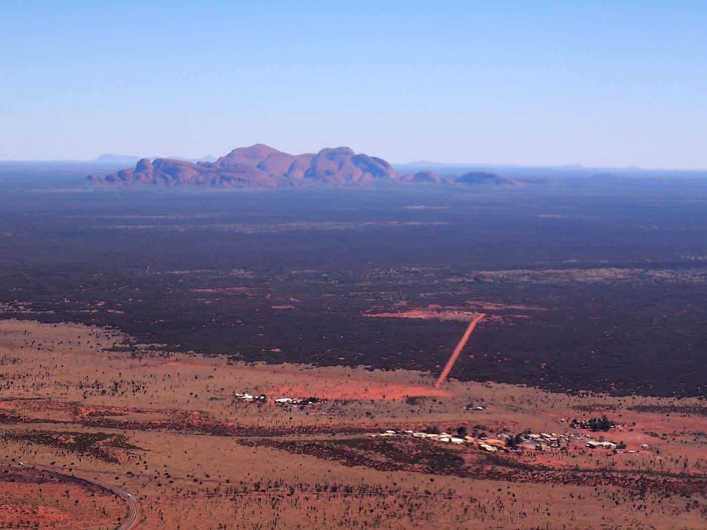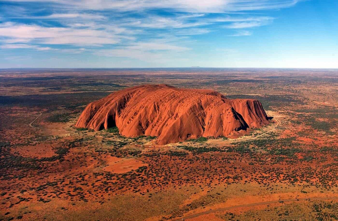
Uluru rises abruptly from the flat red plains of Central Australia, about 348 m high and several kilometres around its base. Thirty-odd kilometres to the west, the 36 domes of Kata Tjuta form a cluster of giant rounded rocks. Both are sacred to Anangu, the Traditional Owners, and are protected within Uluru-Kata Tjuta National Park, a World Heritage area listed for both its natural and cultural values.
From the ground, Uluru is overwhelming in its scale. From the air, you see how it and Kata Tjuta sit in a vast landscape of sand dunes, desert oaks and salt lakes stretching to the horizon. This guide covers what you'll see, how flights work, when to go and how to fly respectfully.
~348 m
Height of Uluru
Above the surrounding plain
36
Domes of Kata Tjuta
Mount Olga is the tallest
2019
Climb closed
At Anangu request
Anangu and country
Uluru and Kata Tjuta are places of great cultural significance to Anangu, whose law, known as Tjukurpa, guides their care for this country. The national park is jointly managed by Anangu and Parks Australia. Visitors are asked to respect cultural values, including not photographing certain sensitive sites, which are signposted on the ground.
The Uluru climb was permanently closed in October 2019. Today, visitors experience Uluru through base walks, cultural tours, art, sunrise and sunset viewing, and scenic flights.
How flights work
Scenic flights depart from Yulara, the resort town just outside the park, near Ayers Rock Airport. Operators typically collect passengers from their accommodation.
Flights operate under rules that keep aircraft at prescribed distances and heights from Uluru and Kata Tjuta. This limits noise for visitors on the ground and respects Anangu wishes. As a result, you'll see the formations from the side and at a distance rather than flying directly over them, which is often the best angle for photos anyway.
Helicopter or plane?
Both helicopters and small planes offer scenic flights at Uluru.
- Helicopters fly lower and slower, with large windows, and can turn to give everyone a view. Flights range from short loops around Uluru to longer flights including Kata Tjuta.
- Fixed-wing aircraft are often less expensive per minute and can cover more ground on longer flights, such as to Lake Amadeus or Kings Canyon.
Read our guide to helicopters versus planes.
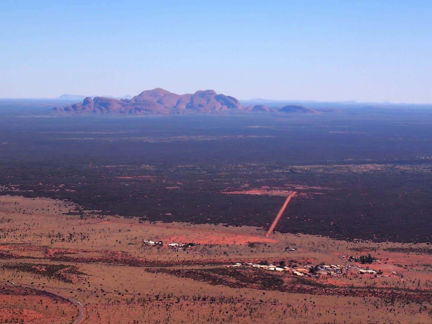
What you'll see
- Uluru in its full shape, with gullies, caves and waterholes around its base.
- Kata Tjuta, its domes divided by deep valleys such as Walpa Gorge and the Valley of the Winds.
- The dune country, with parallel sand ridges, desert oaks and spinifex.
- Lake Amadeus, a huge salt lake north of the park, on longer flights.
- Mount Conner, a flat-topped mesa to the east, on some longer flights.
Best time of day
- Sunrise and early morning. Soft light, long shadows and usually calmer air. Morning flights can be cool, especially in winter.
- Late afternoon and sunset. Warm light brings out the red of the rock. Afternoon thermals can make flights bumpier in hot weather.
- Midday. Flatter light and, in summer, heat and turbulence.
When to go
Central Australia has hot summers and mild winters with cold nights.
- May to September is the most popular time, with clear days, mild temperatures and cold nights.
- October to April is hot, and summer temperatures can be extreme. Summer storms can bring dramatic skies and, occasionally, waterfalls running off Uluru.
Flights operate year-round, weather permitting. Strong winds, storms and dust can cause cancellations.
Photography tips
- Wear dark clothing to reduce window reflections.
- Ask whether your flight has opening windows or doors-off options.
- Keep your camera settings simple and fast, as the view changes quickly.
- Respect cultural sensitivities when sharing photos; certain sites aren't meant to be photographed.
Uluru flight checklist
0 of 7 done
Ticks are saved in this browser only.
Combining a flight with your visit
Most visitors spend two to three days at Uluru. A scenic flight complements base walks, cultural tours, the Kata Tjuta walks and sunrise and sunset viewing. Book flights early in peak season, especially at sunrise and sunset.
Common mistakes
- Expecting to fly directly over Uluru.
- Booking a flight on your departure day with no buffer for weather.
- Underestimating how cold winter mornings can be.
Travelling with children
Many operators accept children, but rules vary on minimum ages, seats and harnesses. Short flights suit younger children. Bring water, as it's very dry.
Cultural etiquette
Anangu welcome visitors to learn about their culture and country. The Cultural Centre near Uluru is a good place to start, with displays, art and information about Tjukurpa. Respect signs asking visitors not to photograph certain sites, and follow these wishes when sharing photos from your flight online.
Other things to do
A scenic flight is just one way to experience Uluru and Kata Tjuta. Others include walking around Uluru's base, the Valley of the Winds and Walpa Gorge walks at Kata Tjuta, ranger-guided and Anangu-guided tours, art centres, camel rides, cycling around the base and sunrise and sunset viewing areas. Many visitors combine several of these over two or three days.
Getting there
Ayers Rock Airport, near Yulara, has flights from several Australian cities. Uluru is also reached by road from Alice Springs, a drive of around 450 km, often combined with Kings Canyon in Watarrka National Park.
Kings Canyon
Some longer fixed-wing flights from Yulara include Kings Canyon in Watarrka National Park, with its towering sandstone walls. Helicopter flights also operate at Kings Canyon itself.
Respecting cultural sites
Uluru and Kata Tjuta are sacred to the Anangu traditional owners. Follow park guidance and respect the requests of traditional owners, including restrictions on photographing certain sacred sites.
Seasons in the Red Centre
Central Australia has hot summers and mild winters with cold nights. Summer flights may be scheduled early in the morning to avoid the heat and turbulence. Winter is peak season, so book ahead. Storms occasionally bring rain, and seeing waterfalls flowing on Uluru is a rare sight.
Key points
Scenic flights at Uluru and Kata Tjuta depart from Yulara and follow rules that keep aircraft at set distances from the rocks. Fly early or late for the best light, respect Anangu culture, book ahead in peak season and allow a spare day for weather.
Frequently asked questions
Can helicopters fly over Uluru?
Scenic flights operate under rules that keep aircraft at set distances and heights around Uluru and Kata Tjuta, partly out of respect for Anangu, the Traditional Owners, and partly to limit noise for other visitors. Flights view the formations from the side rather than directly overhead.
Where do Uluru scenic flights depart from?
Flights usually depart from Yulara, the resort town near Ayers Rock Airport, outside the national park. Operators typically offer pickups from accommodation in Yulara.
How high is Uluru?
Uluru rises about 348 m above the surrounding plain. Kata Tjuta's tallest dome, Mount Olga, rises about 546 m above the plain.
What's the best time of day for a flight?
Early morning and late afternoon light brings out the red of the rock and casts long shadows, and the air is often smoother. Midday light is flatter and the air can be bumpier in summer heat.
Is climbing Uluru allowed?
No. The climb was permanently closed in October 2019 at the request of Anangu. Scenic flights, walks around the base, cultural tours and sunrise and sunset viewing are all ways to experience Uluru respectfully.
Do I need a park pass for a scenic flight?
You need a park pass to enter Uluru-Kata Tjuta National Park. Check with your operator whether a pass is needed for your flight, as flights depart from outside the park.
Sources and further reading
Facts on this page were checked against these primary and official sources. Conditions change — confirm before you travel or buy.
- Uluru-Kata Tjuta National Park — Parks Australia
- Uluru-Kata Tjuta National Park — UNESCO World Heritage Centre
- Civil Aviation Safety Authority — Australian Government
- Uluru — Wikipedia